Altitude Notes: Entry Six
Quandary Peak 14.265 Feet Above Sea Level
20-21 March 2022
The Approach
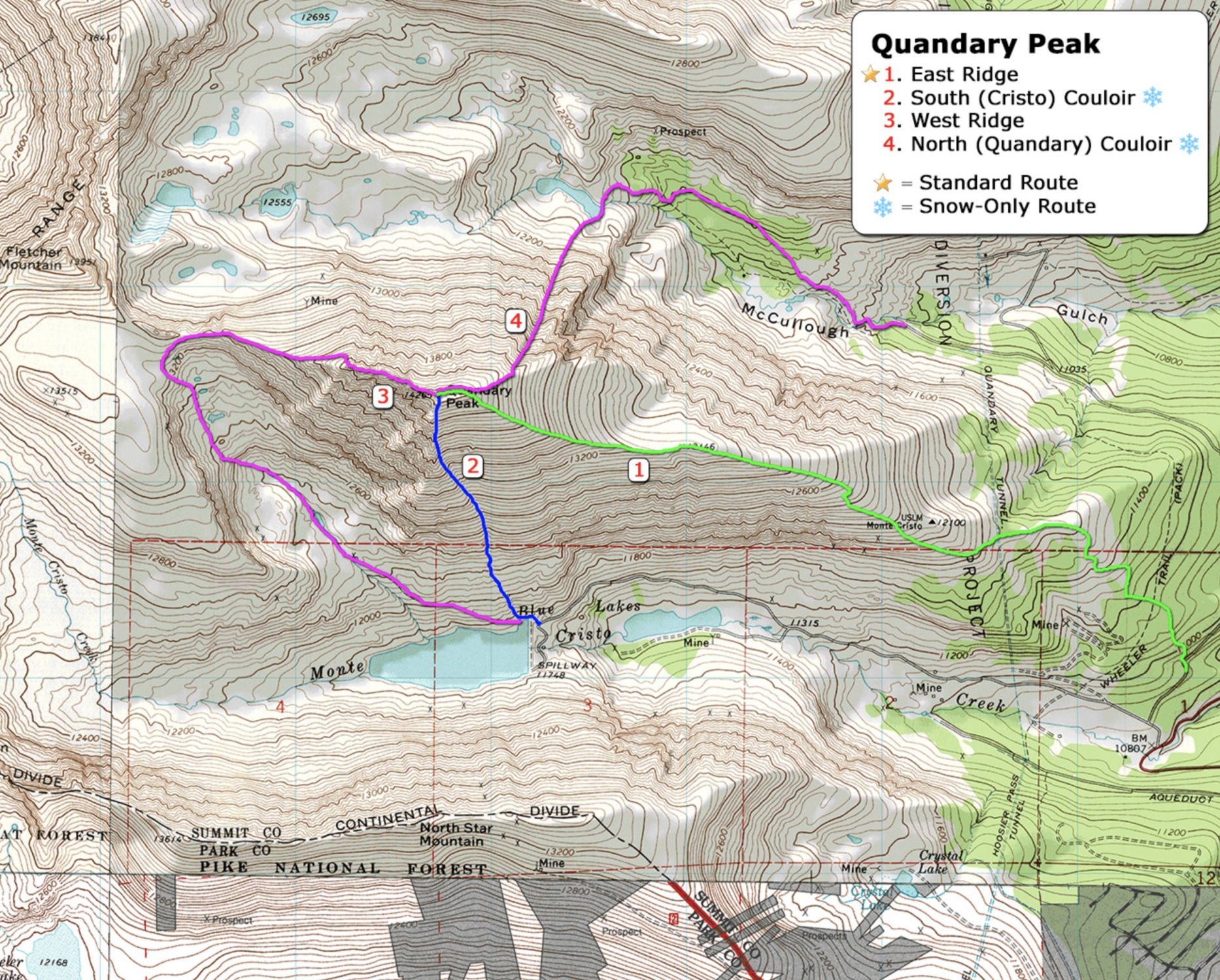
Located just outside of the ski resort town of Breckenridge, Quandary Peak is the 13th highest summit in Colorado as well as being the most popular 14er in Colorado to hike. I had been wanting to take a less traveled route via the Quandary Couloir, but a huge weather system had moved in and avalanche concerns had me rethink the plan.
Rather than risk getting taken out by the unstable snowpack we amended the plan and took the standard route, the East Ridge. I arrived the night before and dirt-bagged it at the trailhead in the back of the 4Runner. With only 2 other cars in the parking lot it looked as though the storm had kept the crowds away.
 The Route
The Hike:
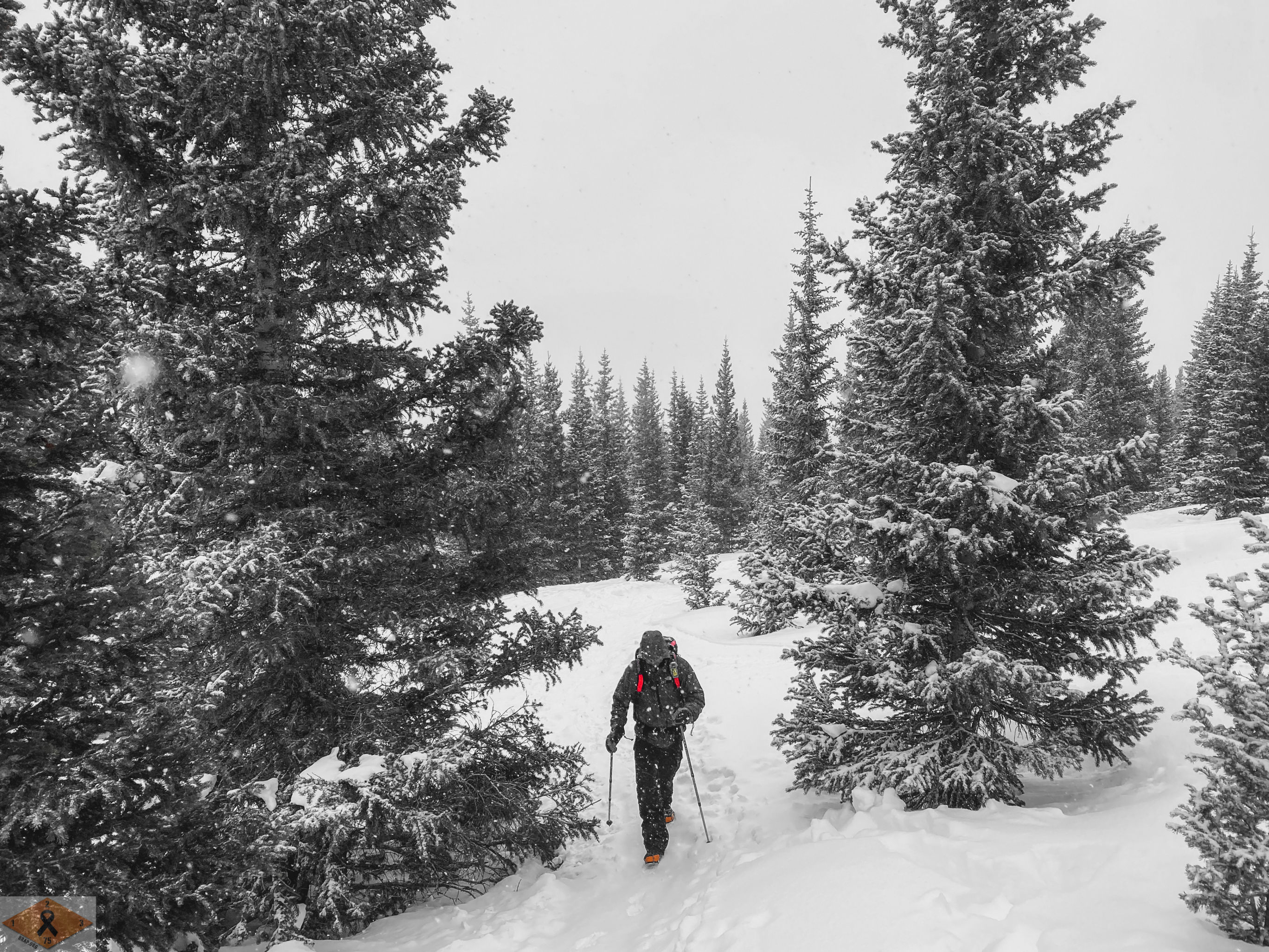
James drove up from Colorado Springs and met me at the trailhead around 5:30 and we were on trail by 6:00 am. The winter trailhead is a short walk from the start point, unlike many of the other 14ers, adding only about 0.1 miles to the hike. We chose to leave the snowshoes behind; due to the popularity of the route we felt confident there would be a trench to the ridge.
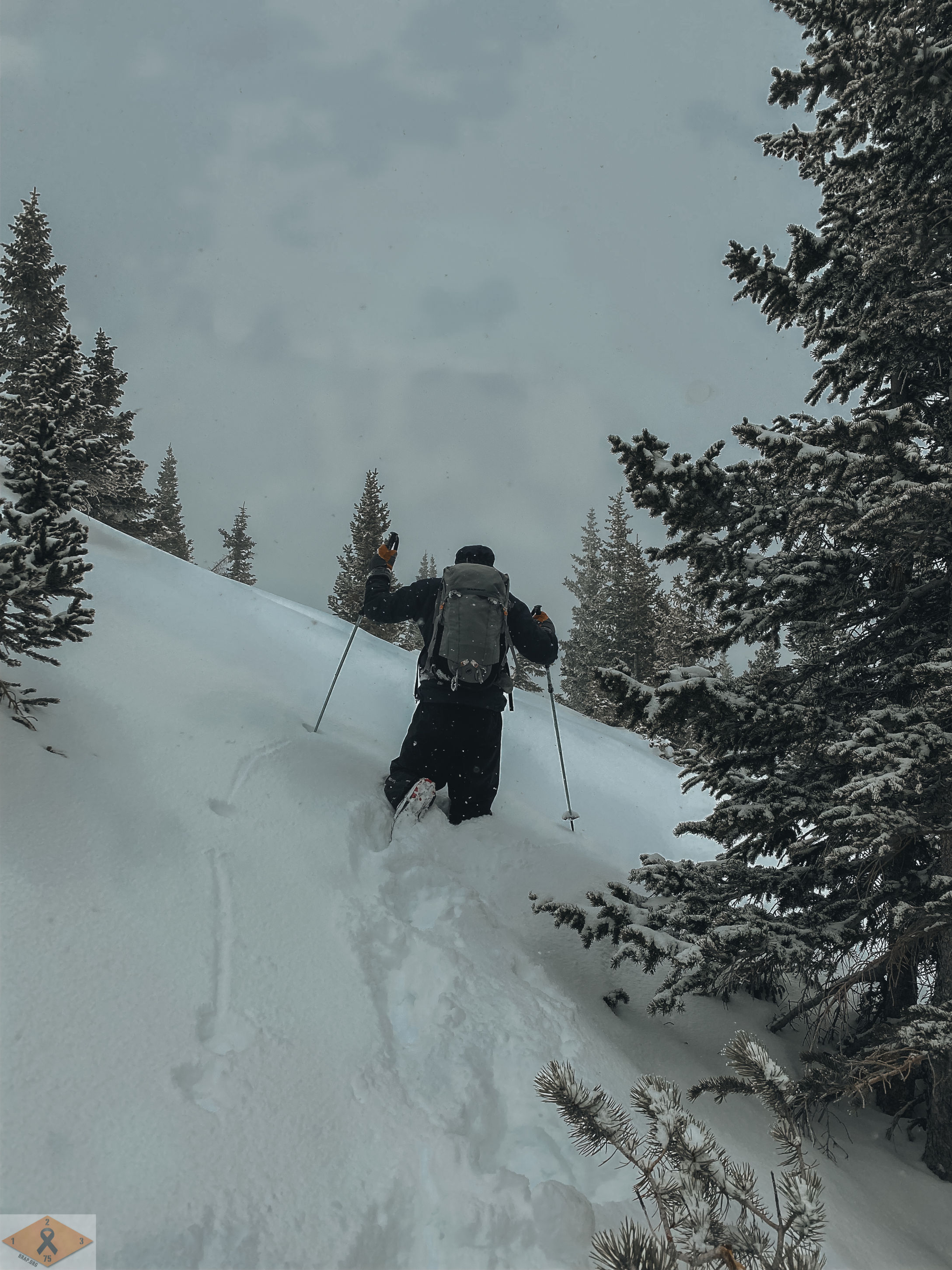
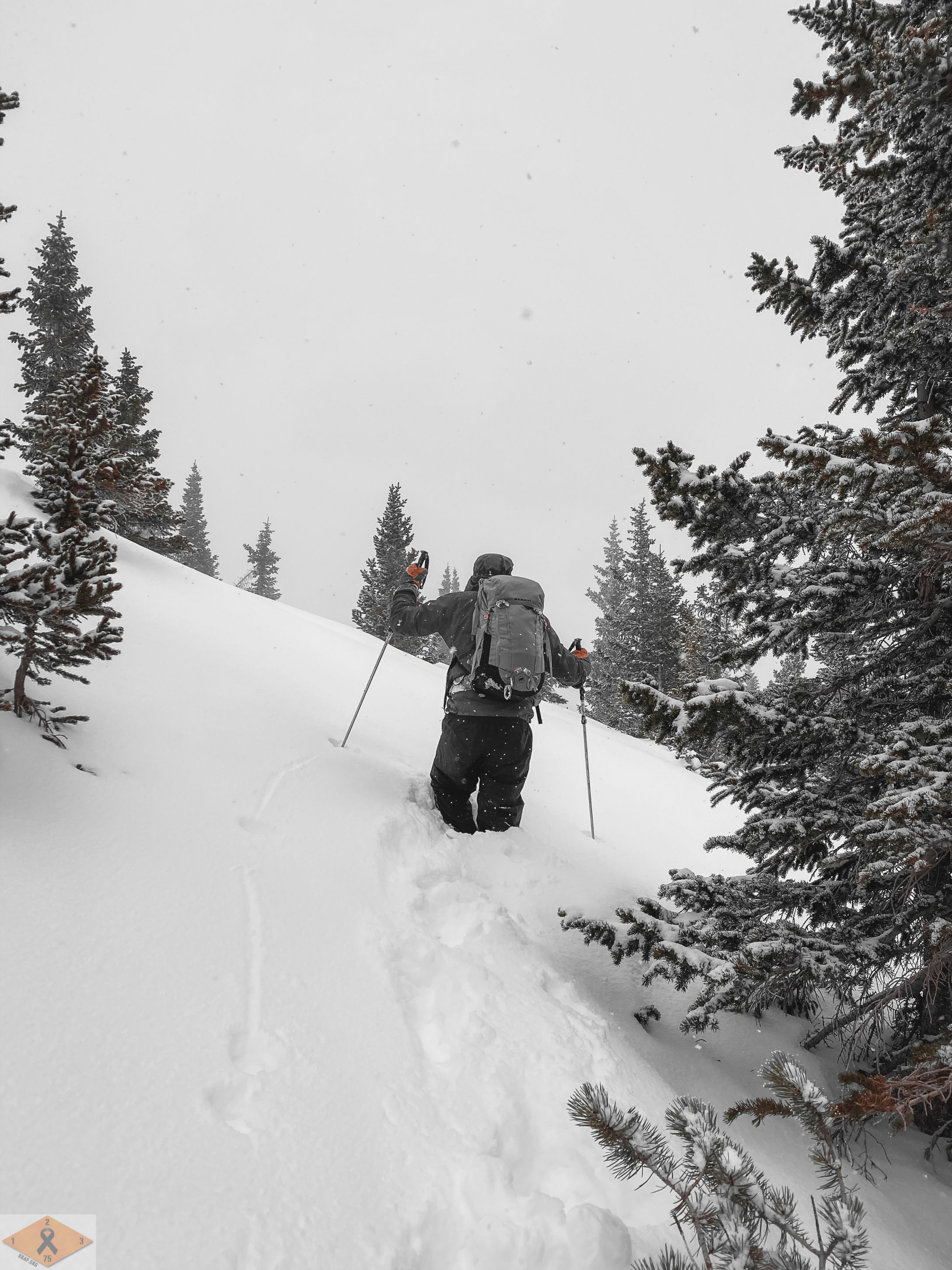
Once in the tree line we were able to follow the trench to about 12,000 feet elevation. At that point the trench disappeared and we had to pick our way through some deep snow drifts. With winds howling, blowing at steady at 30 mph and gusting up to 50 we had our work cut out for us.
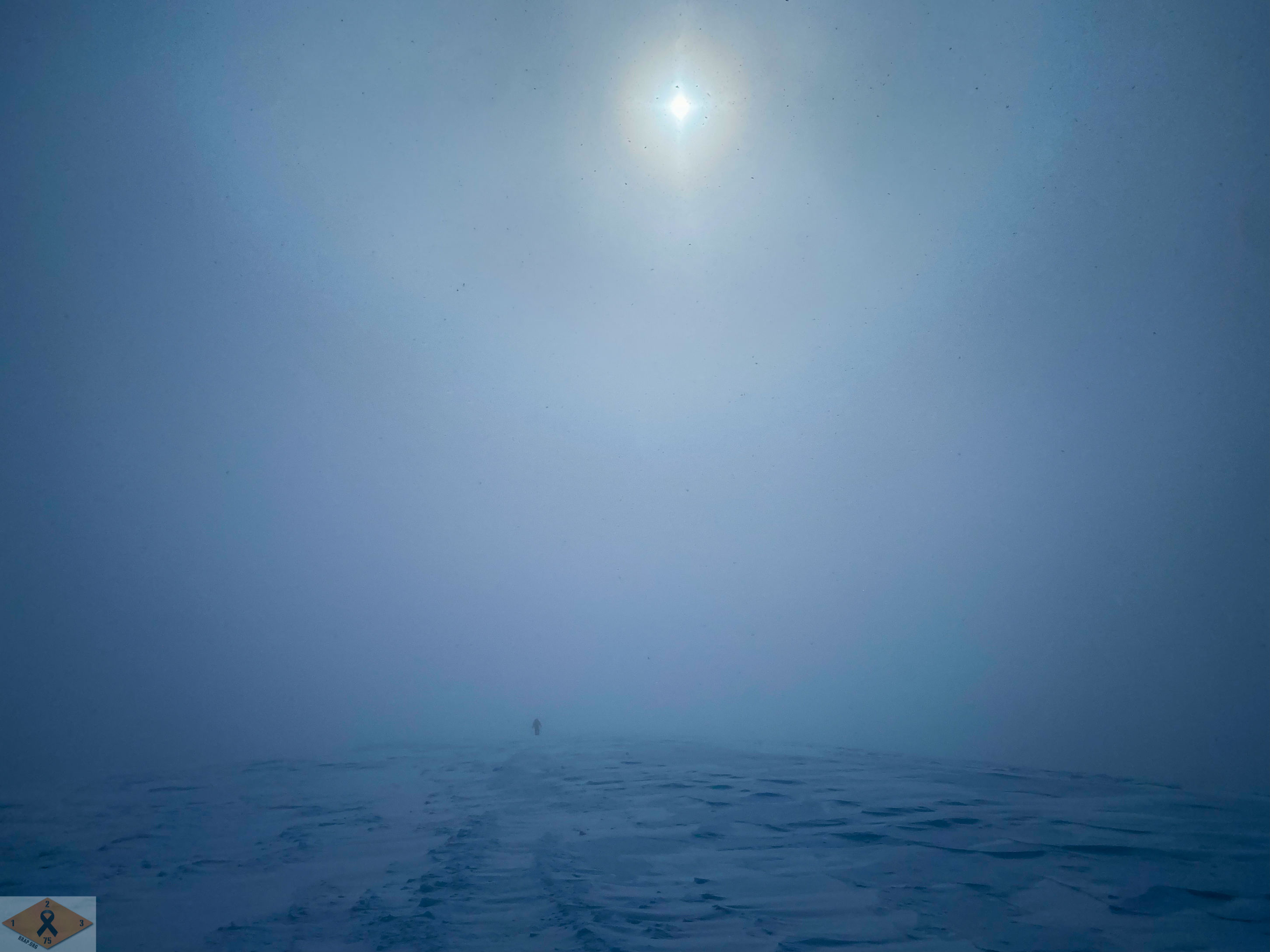
Luckily the wind had blown most of the snow off our path and we were able to navigate around the deeper wind loaded aspect of the mountain. Above tree line we were in white out conditions the rest of the way up, casting an ominous mood on the remainder of the ascent. To this point we had not seen any other hikers leading us to be concerned the weather would keep us from the summit.
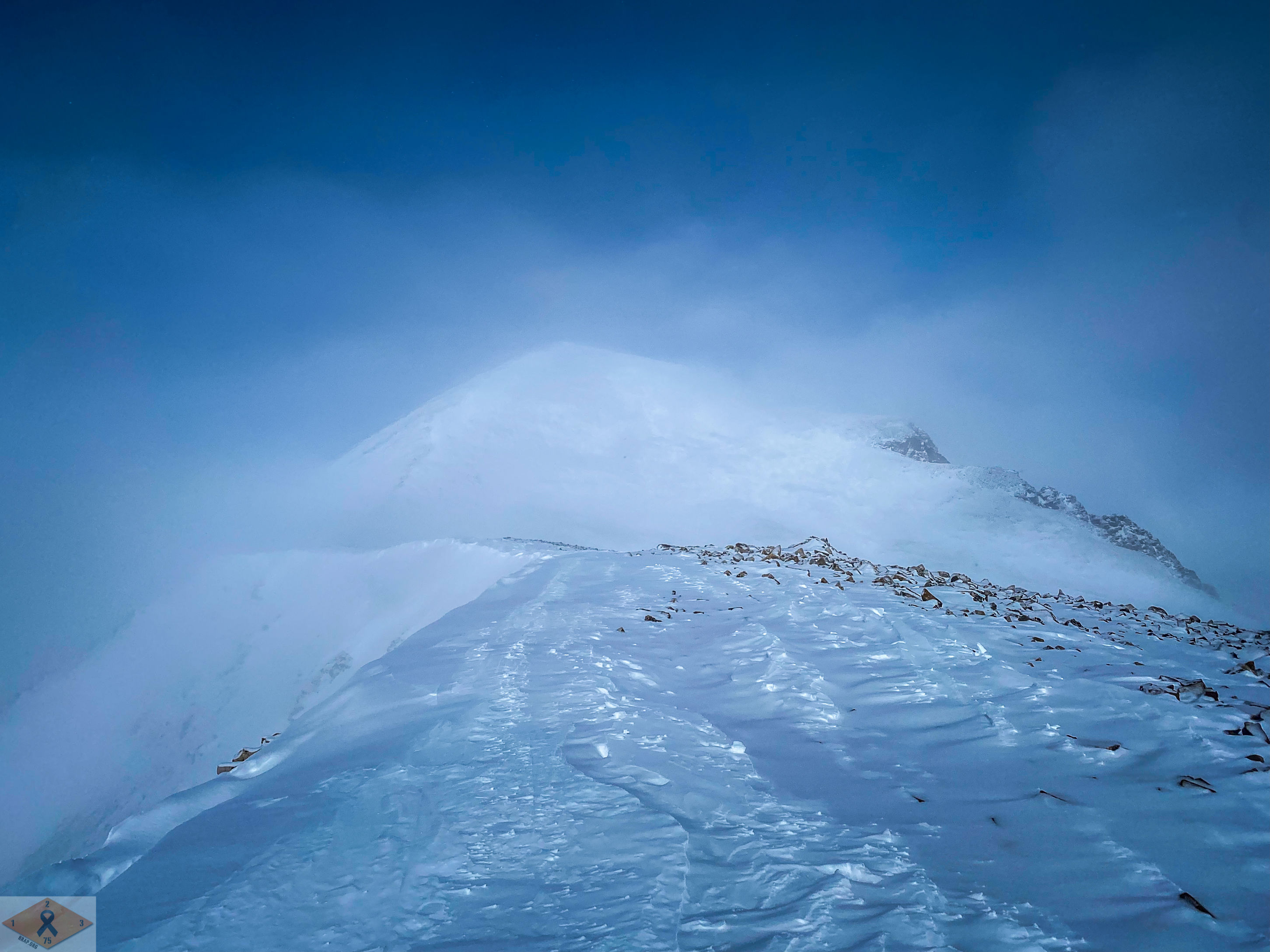
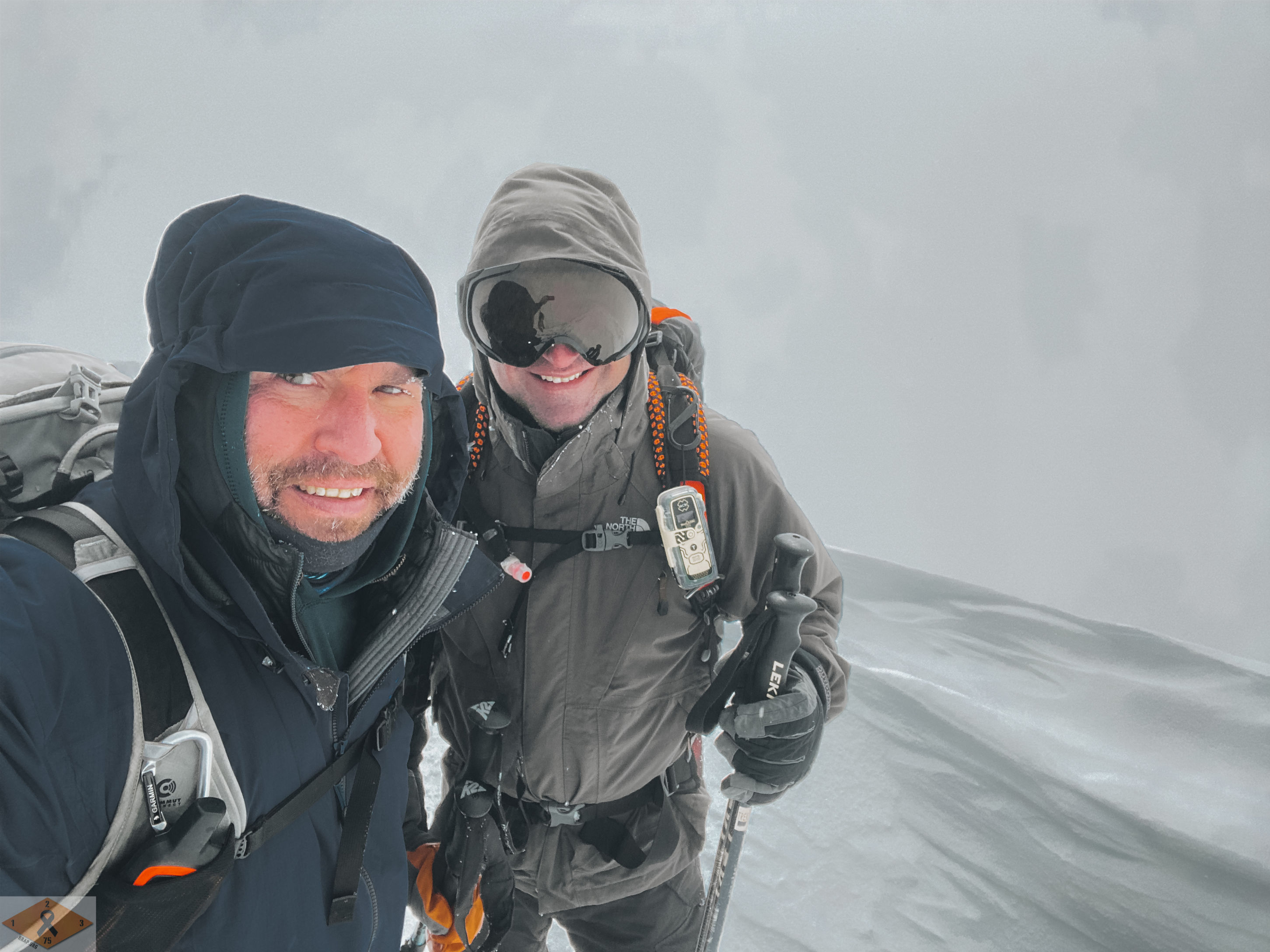
Upon gaining the ridge, there was a short break in the weather and the summit came into view, stoking our resolve to finish this day out. We pushed on, even as the clouds reconverged and winds picked up at full force. Our tenacity was rewarded with the 7th summit of the project.
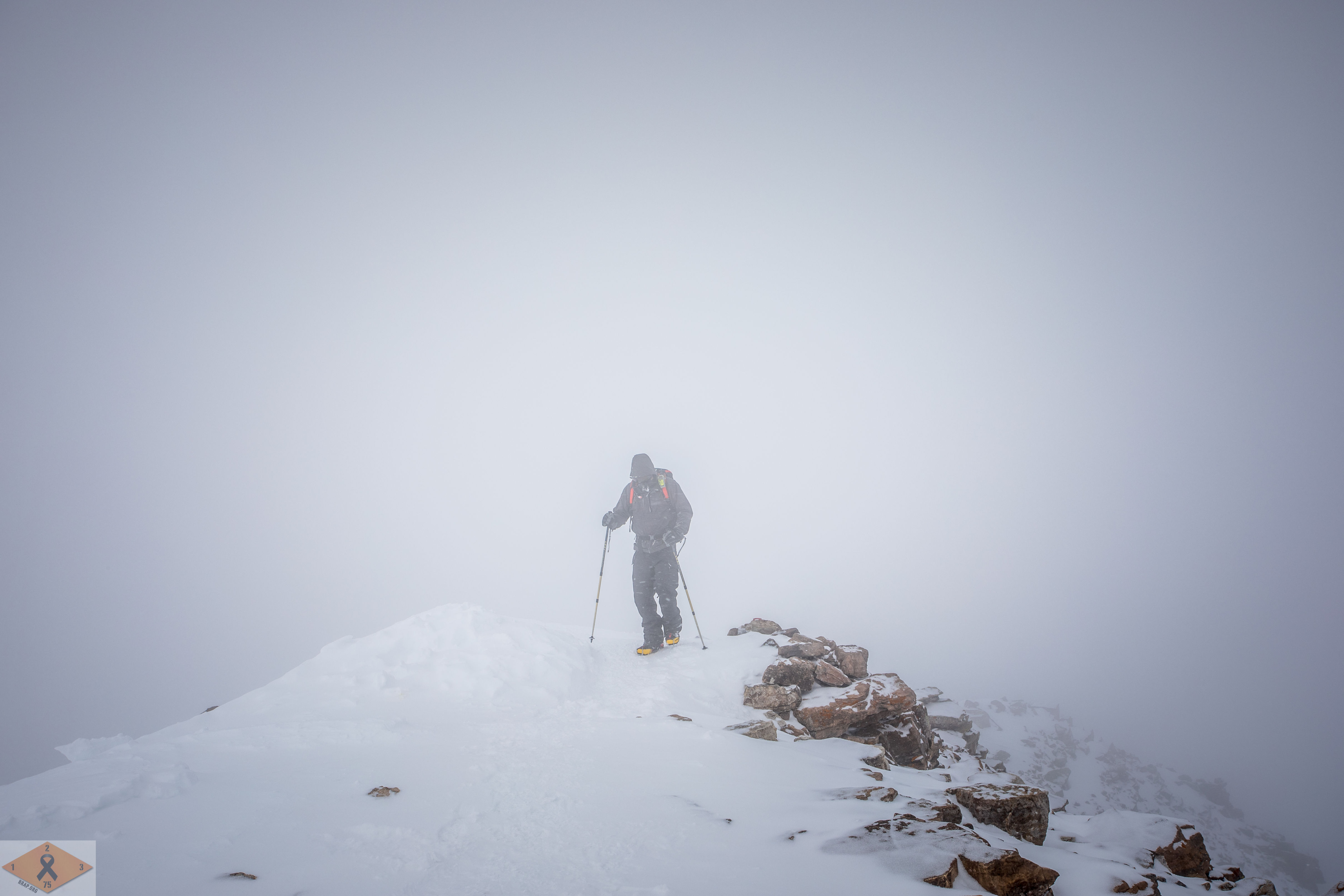
The clouds obscured the views of the surrounding peaks, and with gale force winds pounding us, waiting the storm out didn’t seem to be a viable option. After paying our respects to Corporal Kopp, we started back down.
As we descended the ridge the weather started to deteriorate quickly and route finding became an issue. We stopped multiple times to check our route on GPS, readjusting to follow the same path we had come up. Once below the ridge we were wishing we had the snowshoes, as the post-holing slowed our progress to a crawl. Eventually we were able to find the trench that led to the trailhead.
After we were back at our cars the winds died and the sun finally made its way out from behind the veil of clouds.
Not a calendar winter summit, but the conditions were full on this day. Some character building conditions were had for sure, and all and all some great mountain training in questionable conditions. As they say, there’s no such thing as bad weather, only improper gear.
RLTW!
References:
https://www.14ers.com/route.php?route=quan1